What we generally call continents are giant landmasses on our planet, nested between the surrounding oceans. There is no exact definition or criterion of what is to be considered a single continent, the seven continents are rather based on traditions and conventions.
The largest of the seven continents is Asia, which in itself is only a part of the Eurasian landmass. Due to historical and cultural reasons, however, Asia is taken separately from Europe when we usually talk about continents. In fact only Antarctica and Australia are disconnected completely from the other landmasses by bodies of water. Asia is separated from Africa by the Isthmus of Suez, while North America connected to South America by the Isthmus of Panama.
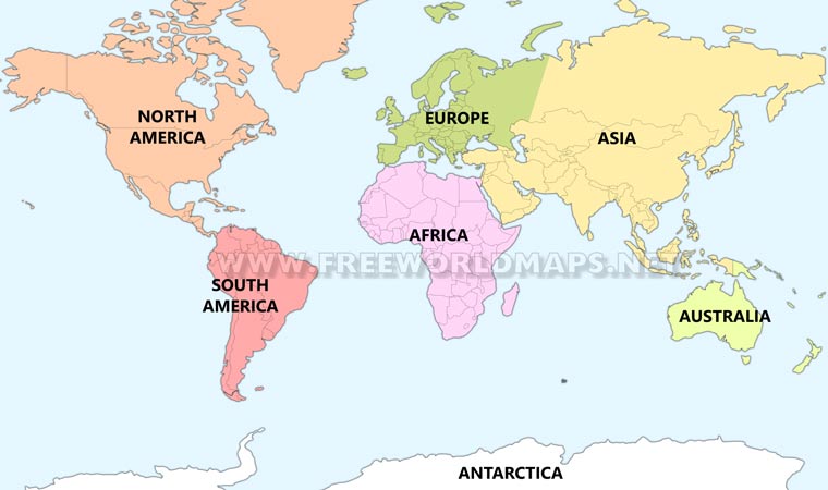
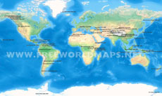
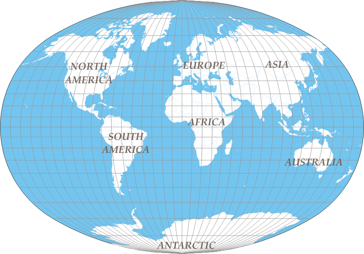
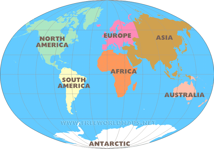
Map of the 7 continents, Miller projection
Click on the map for more detailed continent maps
These distinctions are only true when we accept the seven continents model. Other approaches count only six or five continents by joining North and South America as America, and also connecting Europe to Asia on the joined landmass of Eurasia.
Asia, being the largest of all, is also the home of the highest mountains in the world, and is also by far the most populous continents of all. The second largest and second most populous landmass is Africa, which is often called the black continent. Australia is the smallest of the seven, and is a single country continent.
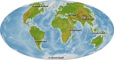
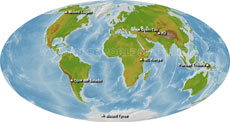
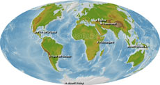
Alternative ways to distinguish continents
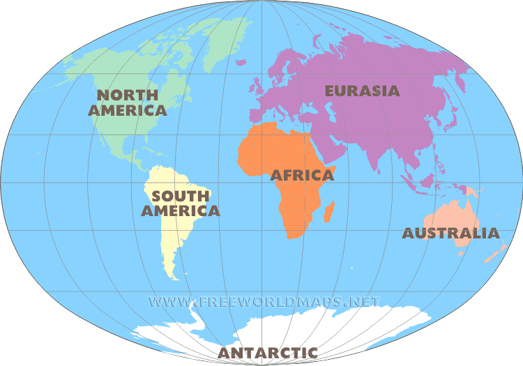
6 continents model North America, South America, Africa, Eurasia, Australia, Antarctic
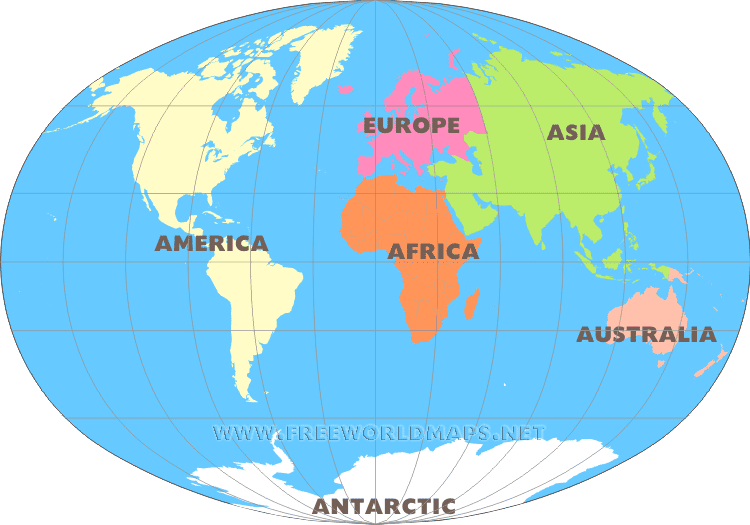
Six continents model America, Africa, Europe, Asia, Australia, Antarctic
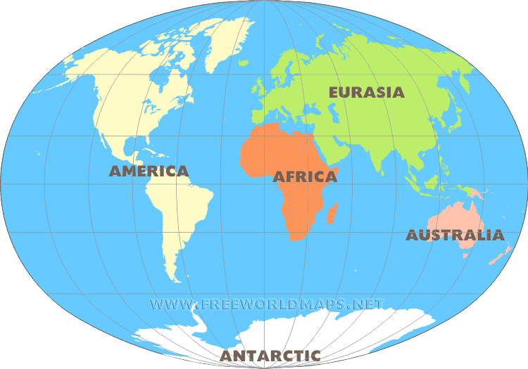
5 continents model America, Africa, Eurasia, Australia, Antarctic
Related maps
Top 50 summits
Seven summits
7 second summits
Volcanic seven summits
Other variants of "seven continent maps"
Map of the Seven Continents
The seven continents of the world are:
Asia
Africa
Europe
North America
South America
Australia
Antarctica
The map shows these continents in a global geographic context and uses the Miller projection to represent the Earth's surface on a flat map.
Click the map to explore more detailed maps of individual continents.
What Is a Continent?
A continent is generally understood as a very large landmass surrounded or separated by oceans and other bodies of water. However, there is no single universally accepted definition of exactly what constitutes a continent.
The number and boundaries of continents are partly based on geographic traditions and conventions. For this reason, different parts of the world and different educational systems may use different continental models.
The seven-continent model separates Europe and Asia, even though they form one continuous landmass known as Eurasia. It also treats North America and South America as separate continents.
The Seven Continents of the World
Asia
Asia is the largest of the seven continents by land area and is also the most populous continent. It extends from the Mediterranean and Middle East across Central and East Asia to the Pacific Ocean.
Asia is home to some of the world's highest mountains, including the Himalayas and Mount Everest, as well as many of the world's largest population centers.
Africa
Africa is the second-largest continent and is also one of the world's major population centers. It is separated from Europe by the Mediterranean Sea and is connected to Asia at the Isthmus of Suez.
Africa contains a remarkable variety of landscapes, including the Sahara Desert, tropical forests, savannas, mountains, and major river systems such as the Nile and Congo.
Europe
Europe occupies the western part of the Eurasian landmass. Although geographically connected to Asia, Europe is traditionally treated as a separate continent because of historical, cultural, and geographic conventions.
Europe includes a large number of countries within a relatively compact area and contains important mountain systems such as the Alps, Pyrenees, and Ural Mountains.
North America
North America is located primarily in the Northern and Western Hemispheres. The continent includes countries such as Canada, the United States, and Mexico, as well as Central American countries and numerous islands and territories depending on the geographic classification used.
North America is connected to South America through the Isthmus of Panama.
South America
South America lies mostly in the Southern and Western Hemispheres. It is home to the Andes, the world's longest continental mountain range, as well as the Amazon Basin and the Amazon River.
The continent is connected to North America through the Isthmus of Panama.
Australia
Australia is the smallest of the seven continents by land area and is also unique because the continent is occupied primarily by a single country, Australia.
Australia is completely separated from the other major continental landmasses by ocean and is part of the broader geographic region often referred to as Oceania.
Antarctica
Antarctica surrounds the South Pole and is the southernmost continent on Earth. It is almost completely covered by a permanent ice sheet and has no permanent indigenous population.
Unlike Europe and Asia, Antarctica is completely separated from the other continents by the Southern Ocean.
Why Are There Seven Continents?
The idea of seven continents is largely based on geographic convention rather than one strict scientific rule.
Asia and Europe are physically connected as part of Eurasia, while North and South America are connected by the Isthmus of Panama. Australia and Antarctica, in contrast, are completely separated from the other continents by bodies of water.
The seven-continent model therefore reflects a combination of physical geography, history, and cultural convention.
Six-Continent Models
There are several alternative ways to divide the continents of Earth.
One six-continent model combines Europe and Asia into Eurasia while keeping North and South America separate:
North America
South America
Africa
Eurasia
Australia
Antarctica
Another six-continent model combines North America and South America into a single continent called America:
America
Africa
Europe
Asia
Australia
Antarctica
Five-Continent Model
A five-continent model can combine both Europe and Asia into Eurasia and North and South America into America:
America
Africa
Eurasia
Australia
Antarctica
These alternative models demonstrate that there is no single definition of a continent that is universally used in every geographic tradition.
Seven Continents Map for Geography and Education
A seven continents map is a useful resource for teaching basic world geography and helping students identify the major landmasses of Earth.
Teachers can use the map for:
Geography lessons
Classroom activities
World geography worksheets
Educational presentations
Homeschooling resources
Online geography courses
Student research projects
Educational websites and publications
Students can use the map to learn the location, relative size, and geographic relationships of the world's continents.
World Continents Map for Reference and Presentations
This map of the seven continents can also be used as a visual reference in presentations, reports, websites, books, and other educational or geographic materials.
The map provides a simple way to identify the world's continental divisions and understand how the major landmasses are arranged across the Earth's surface.
Explore the Seven Continents of the World
Use this seven continents world map to explore the major landmasses of Earth and understand the geographic convention behind the seven-continent model.
From the vast landmass of Asia to the frozen landscapes of Antarctica, the seven continents provide a useful framework for understanding the geography of our planet.