Major Cities of the World

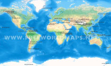
Map showing the location of the cities/urban agglomerations of the world with at least 5 million population. Source of the data is from wikipedia (see below) from year 2012, so please note that the information on this page might be outdated or incorrect.
Click on above map to view higher resolution image


Major Cities of the World – World Cities Map
Explore a world map of major cities and urban agglomerations with populations of approximately 5 million or more. This map shows the geographic distribution of some of the world's largest metropolitan areas across Asia, Europe, Africa, North America, South America, and other regions.
The map provides a visual overview of major global population centers, making it useful for geography, education, research, presentations, publishing, and anyone interested in the world's largest urban areas.
World Map of Major Cities
This major cities of the world map shows the locations of large cities and urban agglomerations around the globe. The accompanying table provides the city or agglomeration name, local name, country, and approximate population.
Cities represented on the map include major urban centers such as Tokyo, Delhi, Mexico City, New York City, São Paulo, Shanghai, Mumbai, Beijing, Dhaka, Kolkata, Karachi, Buenos Aires, Los Angeles, Rio de Janeiro, Manila, Moscow, Osaka, Cairo, Istanbul, Lagos, Paris, Guangzhou, Shenzhen, Seoul, Jakarta, London, Bangkok, Tehran, Madrid, Barcelona, Toronto, Singapore, Riyadh, and many others.
Largest Urban Agglomerations Shown on the Map
The map focuses on urban agglomerations and metropolitan population centers, rather than simply measuring population within official city administrative boundaries. This distinction is important because large metropolitan areas can extend well beyond the boundaries of a single municipality.
For example, the page lists Tokyo at approximately 36 million people, Delhi NCR at approximately 22 million, Mexico City and New York City at approximately 20 million, and São Paulo, Shanghai, and Mumbai at approximately 19 million in the dataset used for the map.
Cities from Around the World
The map includes major population centers from multiple continents, including:
Asia: Tokyo, Delhi, Shanghai, Mumbai, Beijing, Dhaka, Karachi, Manila, Seoul, Jakarta, Bangkok, Tehran, Guangzhou, Shenzhen, and other large urban areas.
Europe: Moscow, Paris, London, Istanbul, Madrid, Barcelona, and other major European cities.
North America: New York City, Los Angeles, Chicago, Miami, Philadelphia, Toronto, Dallas, Houston, and Atlanta.
South America: São Paulo, Buenos Aires, Rio de Janeiro, Lima, Bogotá, Santiago, and Belo Horizonte.
Africa: Cairo, Lagos, Kinshasa, Luanda, Khartoum, Abidjan, and other major African urban centers.
World Cities Map for Geography and Education
A world cities map is a useful resource for teaching and learning about global geography, population distribution, urbanization, and international cities.
Teachers and students can use the map to identify where major urban populations are concentrated and compare cities across different continents. It can also be incorporated into geography lessons, classroom materials, educational websites, reports, and presentations.
Major Cities Map for Research and Presentations
This map can also be useful for researchers, writers, designers, publishers, and businesses that need a visual reference for the location of major world cities.
Common uses include:
- Geography and educational materials
- Research and demographic studies
- Presentations and reports
- Books and publications
- Websites and online articles
- Infographics and data visualization
- Travel and tourism content
- Global business and market analysis
City Names and Approximate Population Data
The page includes a table accompanying the map, with the name of each city or urban agglomeration, local name, country, and approximate population. This makes it possible to use the map as both a visual geographic reference and a searchable list of major world cities.
The dataset includes cities and urban agglomerations with populations around 5 million or more, according to the source used for the original map.
Important Note About the Population Data
The population figures on this page are based on a dataset sourced from Wikipedia and correspond to 2012-era data. The information may therefore be outdated or incorrect. The map should be treated as a historical/reference visualization rather than a current ranking of the world's largest cities.
For current population rankings, definitions and estimates can differ depending on whether a source measures city proper, metropolitan area, or urban agglomeration.
Explore the Major Cities of the World
Use this world cities map to explore the geographic locations of major urban agglomerations and compare the world's largest population centers. The map provides a simple way to understand the global distribution of major cities and the scale of urban populations across continents.
Related World Maps
Explore more geographic resources, including editable world maps, Asia-centric world maps, US political maps, and maps of major geographic features and locations.