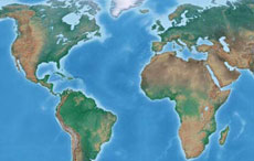
The map shows the situation in year 2012, including the most recent changes in national borders of the countries of the world due to independence of South Sudan, East Timor or Kosovo.
Please note that due to the scale of the map not all countries are shown.
A vector based version of the map is also available for purchase.
Purchase vector based version
Ai (Illustrator), or svg (scalable vector graphic) format of the above map available for only 19.99$ (USD)
After purchase you get a layered svg or ai file that is compatible with almost all vector graphics program, Corel Draw, Adobe Illustrator, Inkscape, etc.
Other world maps
Fully Editable Vector Maps (SVG & Adobe Illustrator .AI Files)
Elevate your publications, presentations, web design, and cartographic projects with high-resolution, fully editable vector maps. Available in industry-standard Adobe Illustrator (.AI) and Scalable Vector Graphics (.SVG) formats, our premium map files give you total creative control over every geographic element, border, color scheme, and text label.
---
Why Choose Premium Vector Map Files?
Unlike static pixel-based images (JPEG or PNG), vector maps are constructed from mathematically defined shapes, lines, and layers. This provides distinct advantages for professional designers, educators, cartographers, and media producers:
- Infinite Scalability: Resize your map from a small mobile UI icon up to a massive billboard poster without any pixelation, blur, or loss of detail.
- Organized Layering: Every geographic element—country borders, river networks, city markers, and topography labels—is placed on separate, clearly named layers for fast toggle and editing.
- Independent Country Polygons: Click, select, recolor, or isolate individual country shapes effortlessly to highlight specific regions, sales territories, or geopolitical data.
- Full Typography Control: Editable text labels allow you to change fonts, languages, label sizes, or placements instantly.
- Cross-Software Compatibility: Seamlessly open and edit files in Adobe Illustrator, Inkscape, Figma, CorelDRAW, Affinity Designer, or GIS applications.
---
What’s Included in the Vector Map Package
| Feature |
Included Layer / Element |
Description & Capabilities |
| Country Borders |
Independent Country Polygons |
Fully closed paths for single-click color fills and selections. |
| Boundaries |
International & Regional Lines |
Vector strokes with customizable thickness, dashes, or styles. |
| Labels & Names |
Country, City & Regional Text |
Fully editable vector text elements sorted by hierarchy. |
| Cities & Capitals |
Multi-Tiered City Markers |
Categorized by population/importance across 4 distinct layers. |
| Hydrography |
Rivers, Lakes & Coastal Lines |
Separate vector paths for water bodies and ocean coastlines. |
| Geographic Grids |
Latitude & Longitude Grids |
Togglable degree grids (e.g., Equator, Tropics, Prime Meridian). |
| Bonus Format |
High-Res Raster Image (PNG) |
Ultra-high-resolution PNG preview included for quick reference. |
---
Primary Use Cases for Editable SVG & AI Maps
1. Graphic Design & Publishing
Design customized infographics, travel brochures, textbooks, and news editorials. Customizing colors, fonts, and ocean styles ensures complete brand alignment for print and digital publishing.
2. Business Intelligence & Regional Data Mapping
Highlight global sales territories, supply chain logistics, trade routes, or franchise locations by coloring individual country polygons or adding pinpoint markers.
3. Interactive Web & App UI Design
Scalable Vector Graphics (SVG) render natively in web browsers. Use our SVG layers to build interactive web maps, CSS hover effects, or dynamic dashboard graphics.
4. Classroom Education & Print Media
Create tailored geographical worksheets, student study guides, or large-format classroom posters by filtering out unnecessary layers or adding custom legend keys.
---
Instant Download & Licensing
When you purchase an editable vector map file on FreeWorldMaps.net, you receive an immediate download package containing:
- 1x Adobe Illustrator (.AI) File (Native layered project file)
- 1x Scalable Vector Graphic (.SVG) File (Standard web and vector software format)
- 1x High-Resolution PNG Image (For immediate preview and draft layouts)
Royalty-Free License
All purchased vector maps include a commercial, royalty-free license. You are permitted to use the maps in commercial presentations, published books, corporate websites, advertising materials, and broadcast media without recurring licensing fees.
---
Frequently Asked Questions (FAQ)
What software do I need to edit these files? You can use any vector graphics software. Adobe Illustrator (.AI) offers the native layered environment, but free open-source tools like Inkscape, as well as UI platforms like Figma or vector tools like Affinity Designer and CorelDRAW, open and edit the SVG format effortlessly.
Can I isolate and extract a single country or continent? Yes. Every country is built as a distinct, closed polygon shape. You can select an individual country, copy it to a new project canvas, change its color, or scale it independently.
Are the map text labels converted to paths or editable text? Labels are preserved as editable vector text layers, allowing you to change fonts, adjust font sizes, or translate country names into different languages.
How do I get my files after payment? After completing your purchase via our secure checkout, you are immediately provided a direct download link on screen and via email to access your zipped vector package instantly.
Customized Countries of the world maps
Could not find what you're looking for?
We can create the map for you!
Crop a region, add/remove features, change shape, different projections, adjust colors, even add your locations!